Success built on collaboration and creative problem solving
projects
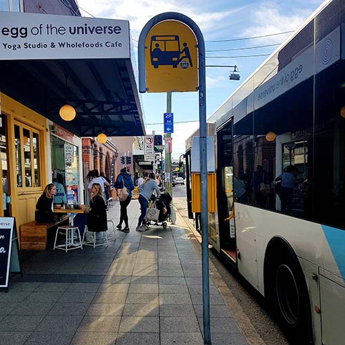
Austral and Leppington North Bus Services & Infrastructure Plan

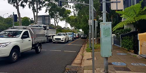
Edmondson Avenue Traffic Signal Investigations

North-West Precinct Land Use Planning
Sydney Road Network Plans & Strategies
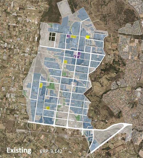
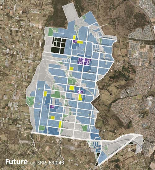
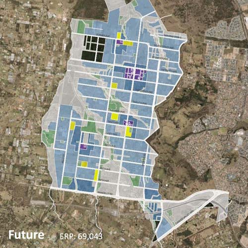
Austral and Leppington North Bus Services & infrastructure plan
Austral and Leppington North is a planned precinct located in the North West Growth Area. It is currently home to around 3,000 residents across low-density residential land uses and farmsteads. By 2036, the Precinct is planned to reach population targets of around 70,000 residents. This will be a density similar to today’s Cammeray in the Lower North Shore or Randwick in the Eastern suburbs.
Over the last two years, development across the greenfield site has accelerated and with it the need to build new transport infrastructure to support the newly arriving residents and businesses. However, Council is experiencing rapid change in the patterns and speed of development across the site since the Department of Planning had published its plan for the precinct back in 2012. The key driver of change is Greater Sydney Commission’s vision of a Western Sydney Parklands City and Aerotropolis, both positioned a stone’s throw west of the site.
With this shift in development policy, patterns and intensity, Liverpool City Council commissioned Crossley to review the Infrastructure Strategy for the Precinct, in particular for public transport. Our team reviewed the planned road network and assessed the level of accessibility to bus services across the Precinct. We reviewed the key changes to planned infrastructure and co-developed a new bus route plan including the roads to be built to support bus services and the location of bus stops in consultation with key stakeholders.
The result of our work included public transport accessibility mapping and a prioritised action plan for the Austral’s new infrastructure.
Date: October 2019 – January 2020
Client: Liverpool City Council
Service Sector: Government
Discipline:


Edmondson Avenue Traffic Signal Investigations
Edmondson Avenue is located in the suburb of Austral in Liverpool Council. Austal is currently a greenfield site with a population subject to grow from around 3,000 residents today, to 70,000 by 2036. To support this growth, Edmondson Avenue is set to transform from a single two-lane carriageway into a sub-arterial corridor and transit boulevard.
Our team was commissioned to assess the future requirement for traffic signals at intersections along Edmondson Avenue, and if so, what year would the warrant be triggered.
To complete this task, the team analysed forecast traffic volumes from a macroscopic traffic model; and manually adjusted volumes to reflect planned development in the immediate vicinity of the intersections.
The forecast volumes were assessed against the Traffic Signal Warrant Criteria for traffic demand, continuous flow and pedestrian volumes at annual increments from 2019 to 2026.
We then assessed the operational performance of the corridor with a combination of signalised intersections to identify the optimal combination of signals required for the safe movement of people without causing adverse delay.
Date: December 2019 – February 2020
Client: Liverpool City Council
Service Sector: Government
Discipline: Transport Planning, Traffic Engineering, Traffic Analysis


North-West Precinct Land Use Planning
Our client, Transport for NSW (formerly Roads and Maritime Services) works everyday with private and public developers to advise, assess and regulate projects and development proposals located on or in the immediate vicinity of the State road network.
Crossley has been working with Sydney’s North West Land Use Planning Team which includes the North West Growth Centre, Macquarie Park and Parramatta to assess development applications (DA’s). As an embedded member of the team, we have been responding to Pre-DA’s, DA’s and State Significant Developments on matters regarding Roads and Maritime Services as part of the Environmental Planning and Assessment Act 1979 Parts 3A, 4 and 5 including the Roads Act – and works authorisation deed requirements.
Our work has involved assessing road design layouts, access arrangements and the impact of vehicle trips generated by each site on the immediate State road.
Within a period of three months our team responded to more than one-hundred development applications.
Date: October 2019 – February 2020
Client: Transport for NSW (formerly Roads and Maritime)
Service Sector: Government
Discipline: Development Planning
Sydney Road Network Plans & Strategies
A city’s roads and streets are contested spaces. They form our key links to move people and goods from place to place and form the majority of a City’s public space. This creates a tug-o’-war between transport modes and place activities; generating complex decisions in how and when to prioritise one over the other.
To help manage this contest and support planning for successful places for people; Transport for NSW (Transport) released a draft Road Planning Framework. The framework is based on the Movement and Place concept which integrates a multidisciplinary approach to planning and managing road corridors.
Stephanie, our Team’s Transport Planning Specialist, was commissioned to develop and pilot the movement and place approach to investigate and develop State road strategies across a 20-year horizon. This involved developing processes, testing and interpreting metrics, and creating technical report templates and contract briefs.
Later, Stephanie transitioned to become the Transport Planning Leader and Project Manager within Transport’s Sydney Planning Team. Here she has investigated analysed and collaborated with stakeholders to co-develop road action plans and strategies for more than one-third of Sydney’s State road network.
Key strategies have included complex parts of the network such as King Street, Newtown and Princes Highway, Rockdale; as well as roads that are set to significantly transform in the next decade including Elizabeth Drive, Liverpool and Moore-Oxley Road, Campbelltown.
You can learn more about the application and development of Movement and Place in New South Wales by visiting the Government Architects website.
Date: February 2017 – June 2020
Client: Sydney Planning, Transport for NSW (Formerly Roads and Maritime)
Service Sector: Government
Discipline: Transport Planning